Hiking Stromboli Volcano in Italy

Stromboli is one of Europe’s most active volcanoes. This summer the volcano was becoming increasingly active, and in the time that it’s taken me to make this post, it has had a massive, dangerous eruption. The eruption that happened in July, sadly, injured several people, and one person was killed. I find myself reflecting on how fortunate I am to have had a safe and enjoyable visit to the island, and I am sad that that could not be the case for others who visited so soon after I did. To my knowledge at this time, guided hiking tours to the top of Stromboli Volcano are suspended, and instead there are boat tours being offered to take visitors around the island at night to watch the glowing lava eruptions from a safe distance away.

If name “Stromboli” sounds familiar, you’ve probably heard it used at Italian restaurants; maybe it was the name of the restaurant, or it was used on the menu to name a food item (probably a calzone). Prior to this visit, I was less familiar with where the name Stromboli actually comes from— a volcano. Stromboli is the most active of the volcanic Aeolian Islands, a UNESCO-protected archipelago, situated off the coast of the Italian island of Sicily.
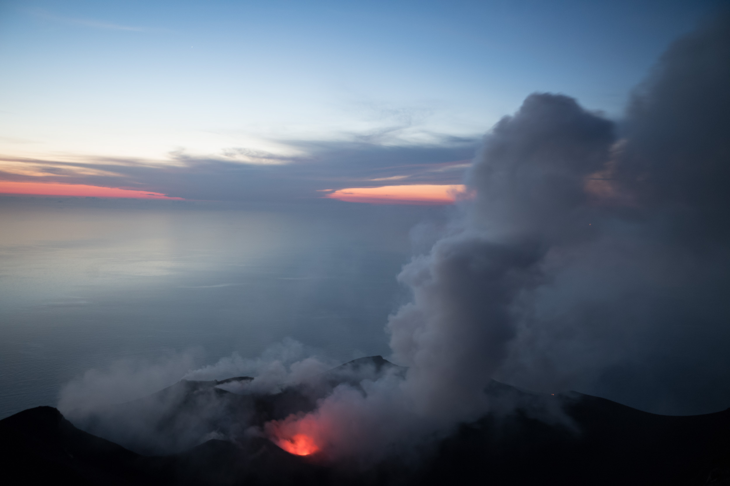
While sailing the Aeolian Islands, my friends and I joined a Stromboli hiking tour group. The hike was a slow, intense, 3-hour-long slog up the steep hillside (2,800 feet of elevation in less that 3 miles). Our group was one of dozens of separate guided hiking groups, all ascending the volcano at the same time (all groups start the hike at 5pm, to arrive around 8). The single file line of hundreds of hikers felt like being part of a slow-motion conga line, scaling a mountain. For most of the way up, there wasn’t much to look at, except my feet as I dragged them up the sandy, volcanic terrain. As we finally neared the top, a glorious panoramic view revealed itself; a pastel sunset, and so many small islands dotting the horizon. Once up there, we got our first glimpse at the massive eruptions of smoke rising out of the volcano.
With permission from my guide, I flew my drone, and captured amazing views of the smoking craters and setting sun. I could not believe how close we were to the spewing pits of smoke. Every few minutes, the ground would rumble, and a massive cloud would belch out of the caldera. The smoke was either white, gray, or pure black, and was filled with big particles of ash. The breeze would catch each cloud of smoke, and push it over to where we were standing, and we had to try our best to avoid breathing in the sulphur-smelling smoke. For some protection I had to wear sunglasses and a buff over my face, keeping my eyes closed for minutes at a time when big clouds would blow into us.

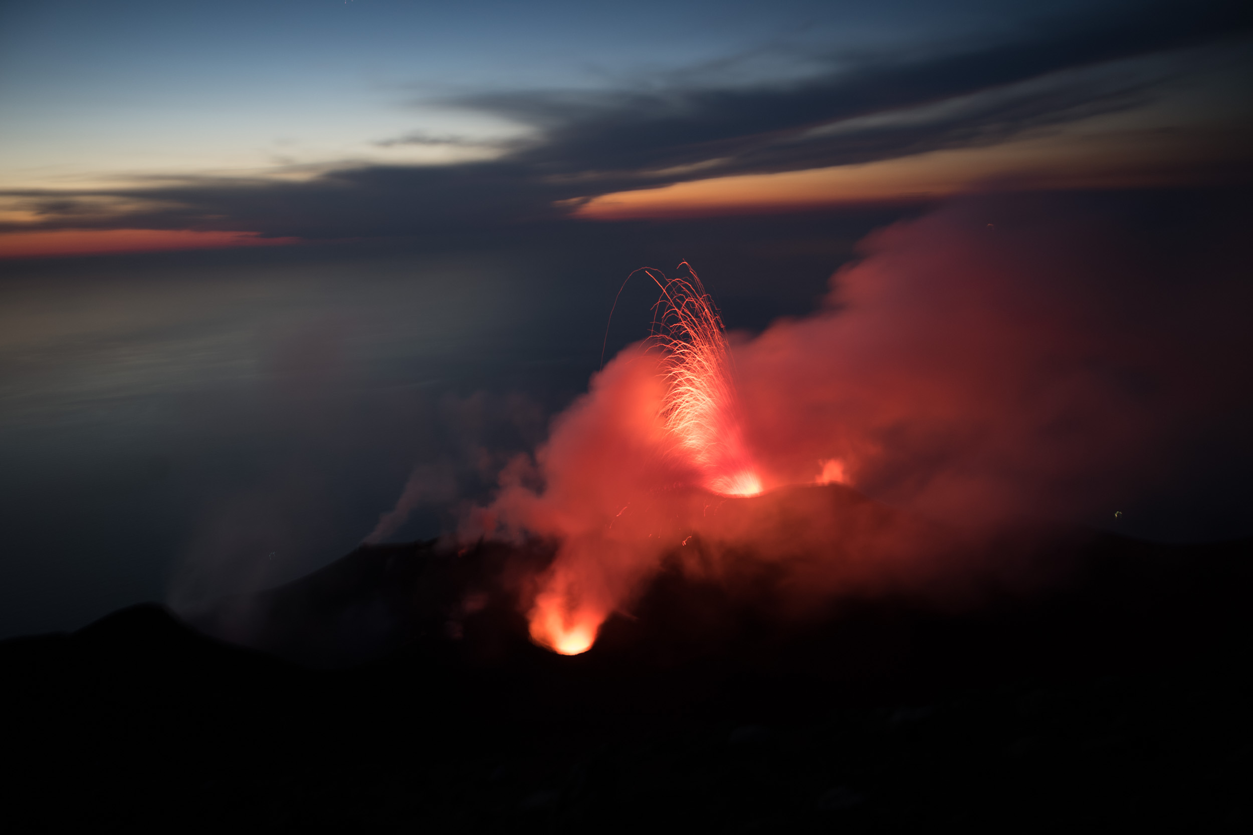
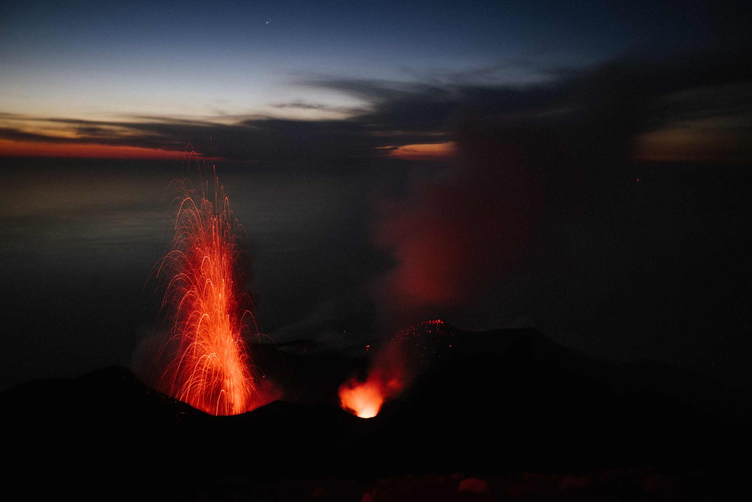
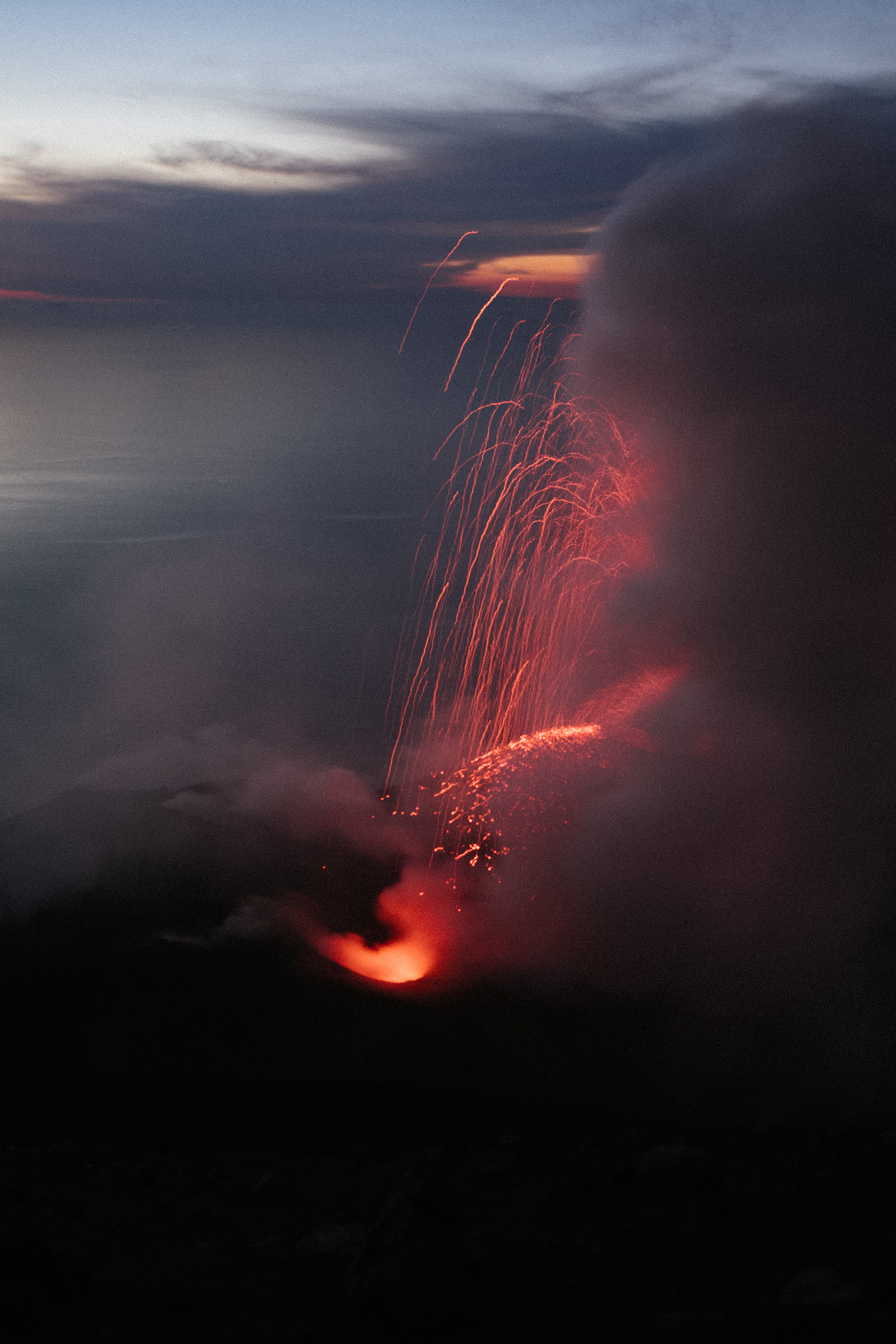
As dusk turned to night, our guide ushered us up the trail even higher, and found us a place to sit above the glowing craters. Now that it was dark, each time the volcano would rumble and blow smoke, we could see sparks shoot up. After about 30 minutes of sitting still and watching these small eruptions, we had become freezing cold. Despite being on top of a steamy volcano in the Mediterranean in June, we had climbed to a higher elevation where it was much colder. We hiked up with extra layers; jackets, beanies, scarves and gloves, which we were all wearing, and still getting cold.
The time had come for the long hike back down. It was now pitch dark, so we each wore a headlamp to illuminate the trail. We did not take the same trail down that we had hiked up, instead we were led down a slightly steeper and more direct route, through deep, volcanic sand. The hike down took almost 2 hours, with very little stopping. The sand was so deep that it was like walking in sand dunes, which was physically demanding in an entirely different way the the hike up had been. As I looked back up the trail, I could no longer see the lava or smoke, but a serpent-like trail of headlamps, all the way up the hillside.