Fjallraven Classic Sweden: 80 miles of Arctic hiking
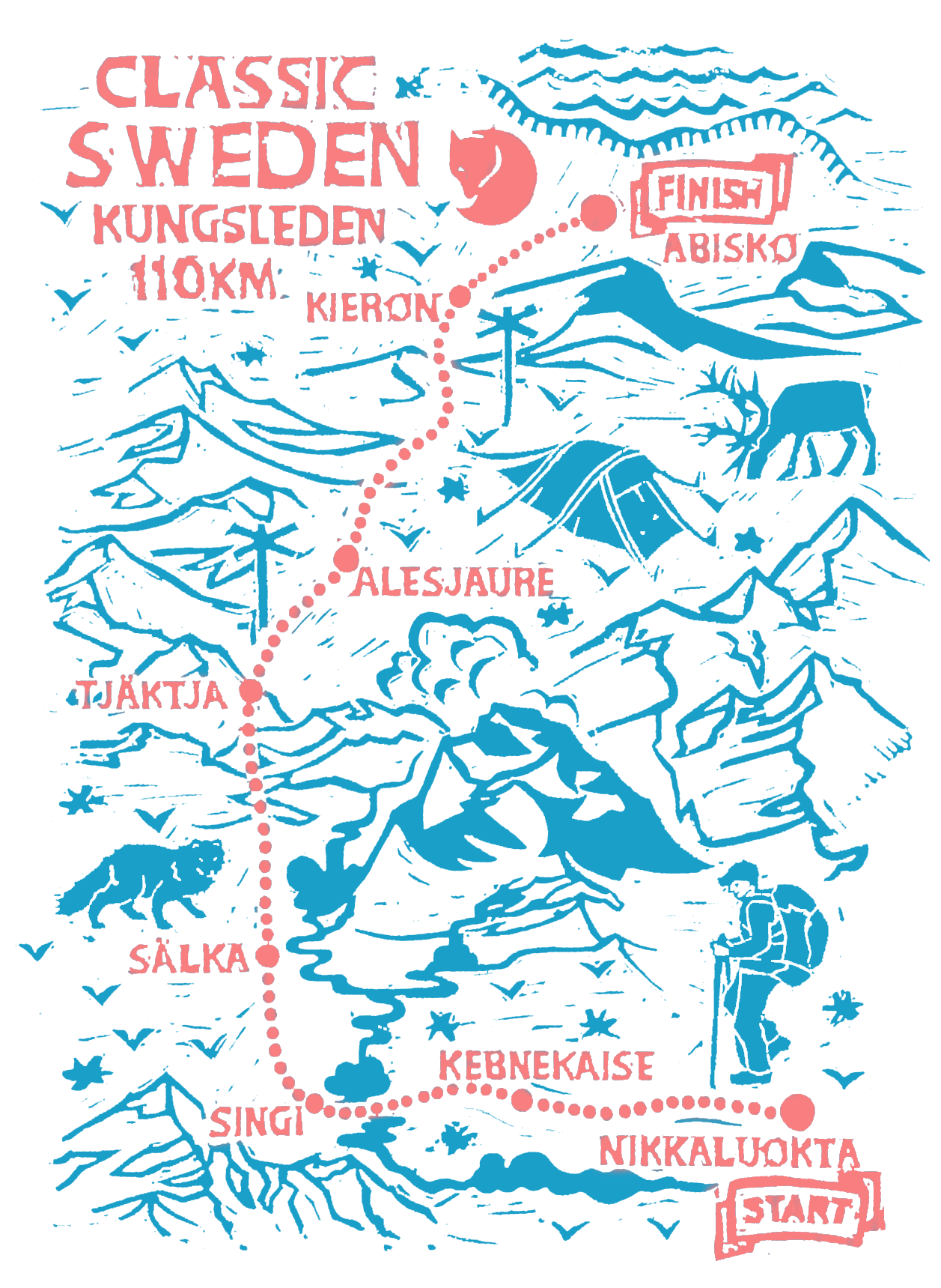
The Fjallraven Classic is a hiking event put on by the Swedish outdoor brand, Fjallraven, as a way to get people outdoors to enjoy nature (and to inspire you to buy a bunch of their very expensive, well-designed products). The Fjallraven Classic Sweden is held in the far northern Swedish Lapland region, and this year it ran from August 9-16. It is a public event, but tickets are limited (they sell out within minutes of going on sale).
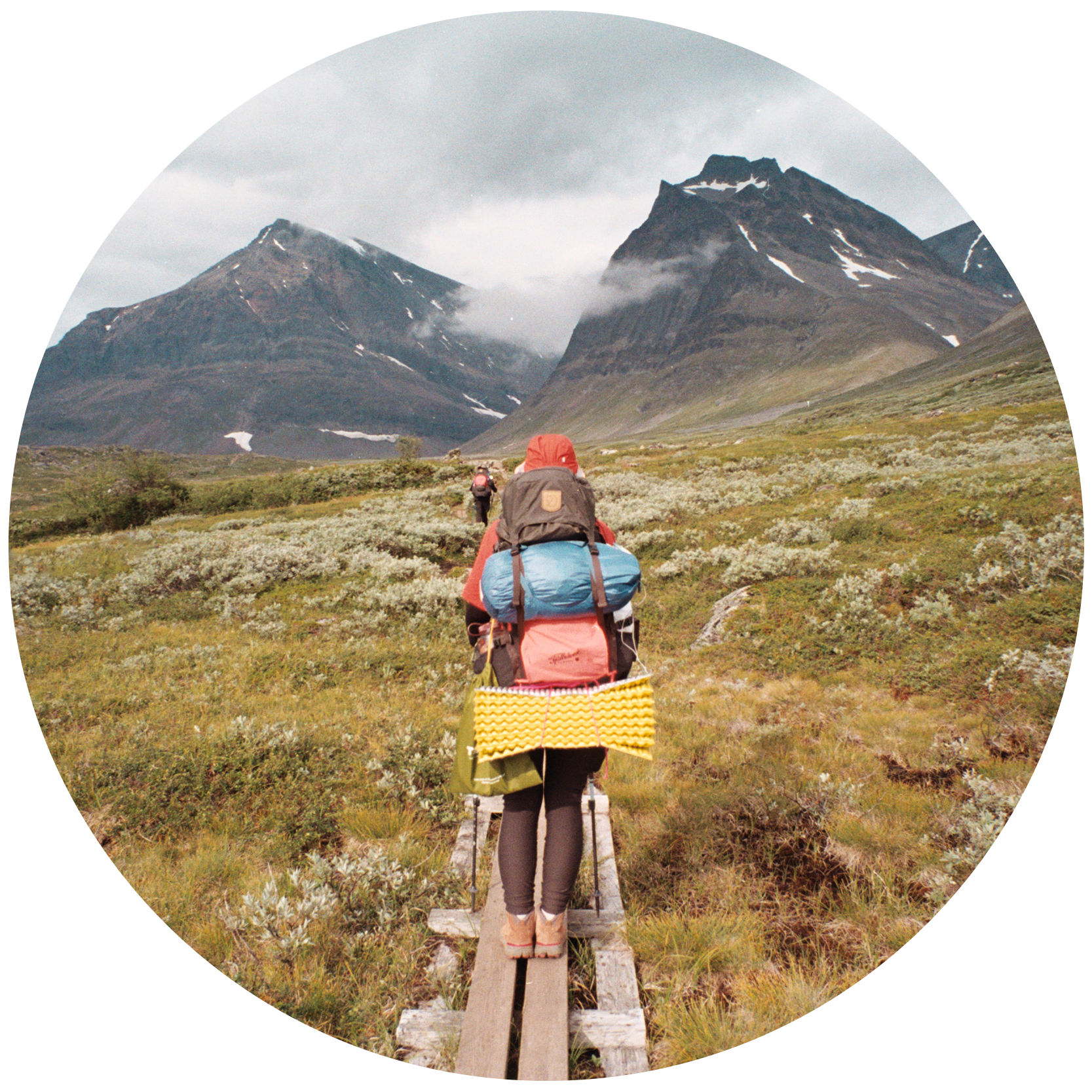
As I started hiking on the Fjallraven Classic trail, I felt a lot of apprehension. I was in rough shape, both emotionally and physically. My cat (who was so much more than just a cat) died the day before my flight to Sweden (very suddenly, due to a undiagnosed medical condition). I was overwhelmed with grief, to the point that I was unable to eat, and it felt like I had come down with the flu. Despite the setbacks to my current mental and physical health, here I was, in Arctic Sweden, embarking on 110 km of trail.
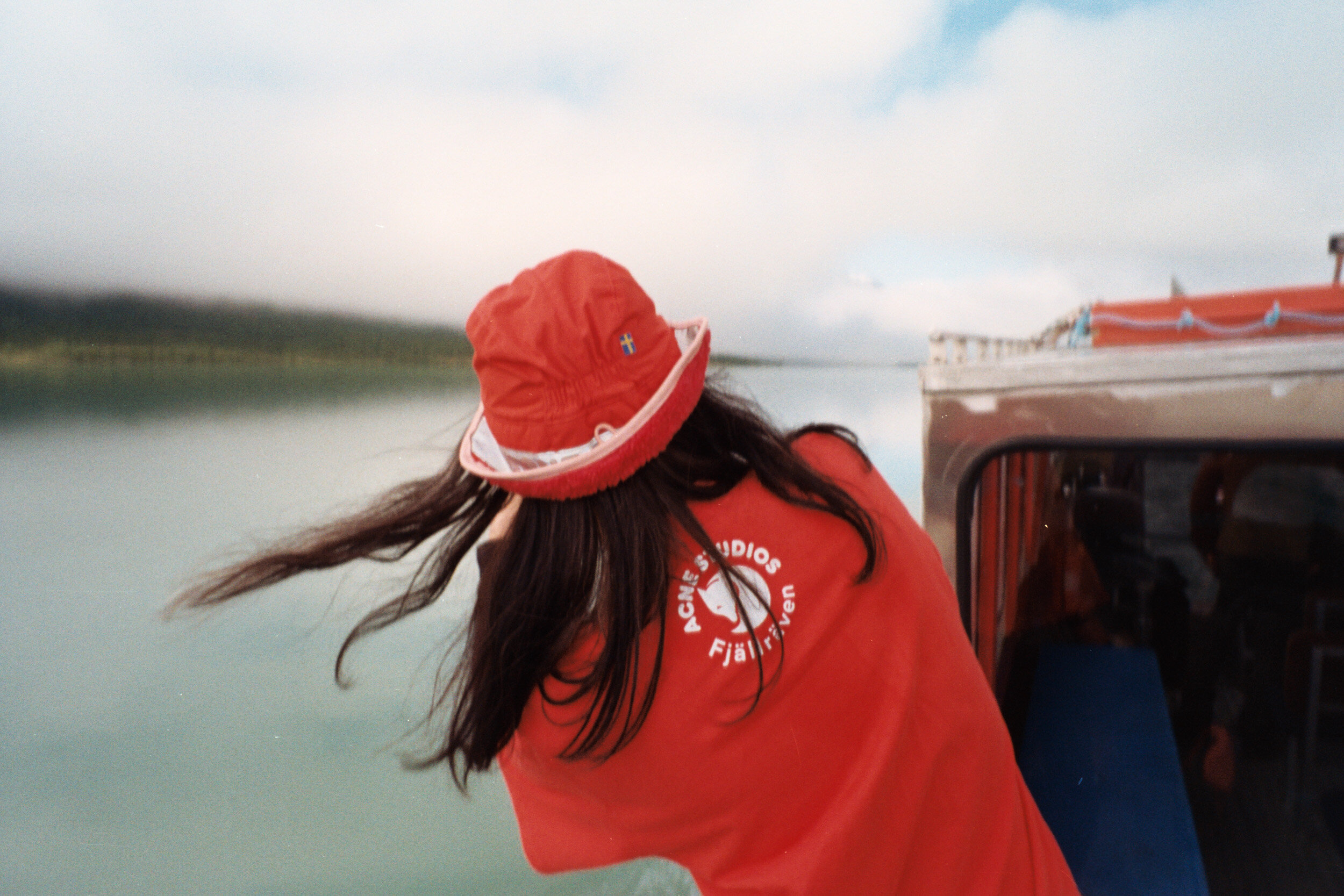
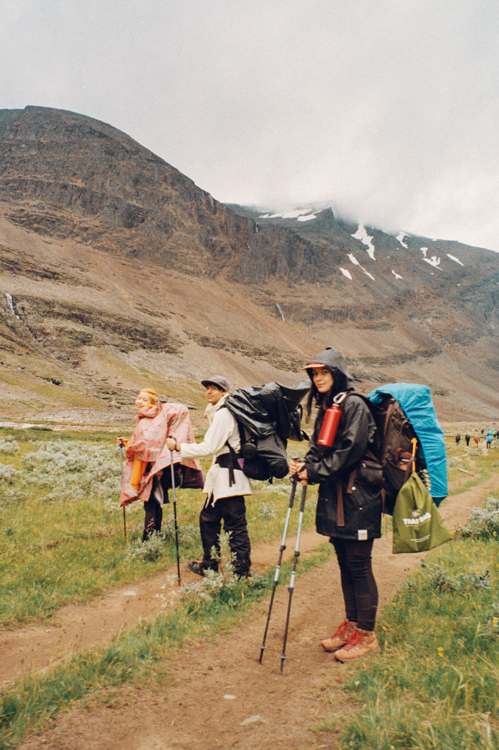
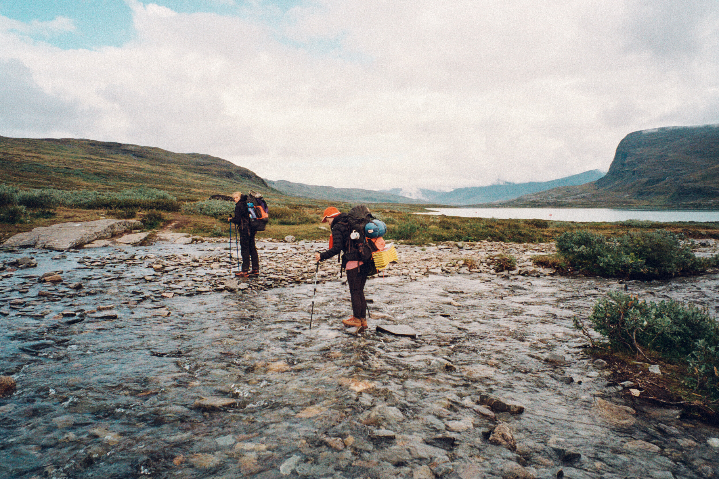
I was far from alone out here, in addition to the 2500 other Fjallraven Classic participants, I was hiking with my two close girl friends; Alex, my roommate and longtime travel companion (we have traveled to 6 continents with one another), and Xenia (who I met when she DMed me about film cameras on Flickr back in 2014). Xenia lives in Stockholm, but we’ve hung out together over the years in California, Sweden, and on one trip together to Budapest. I had the two best possible friends for company and support as I sad-hiked my way across Swedish Lapland. We were also joined by two of Xenia’s friends from, Aya and her husband Andreas who also live in Stockholm.
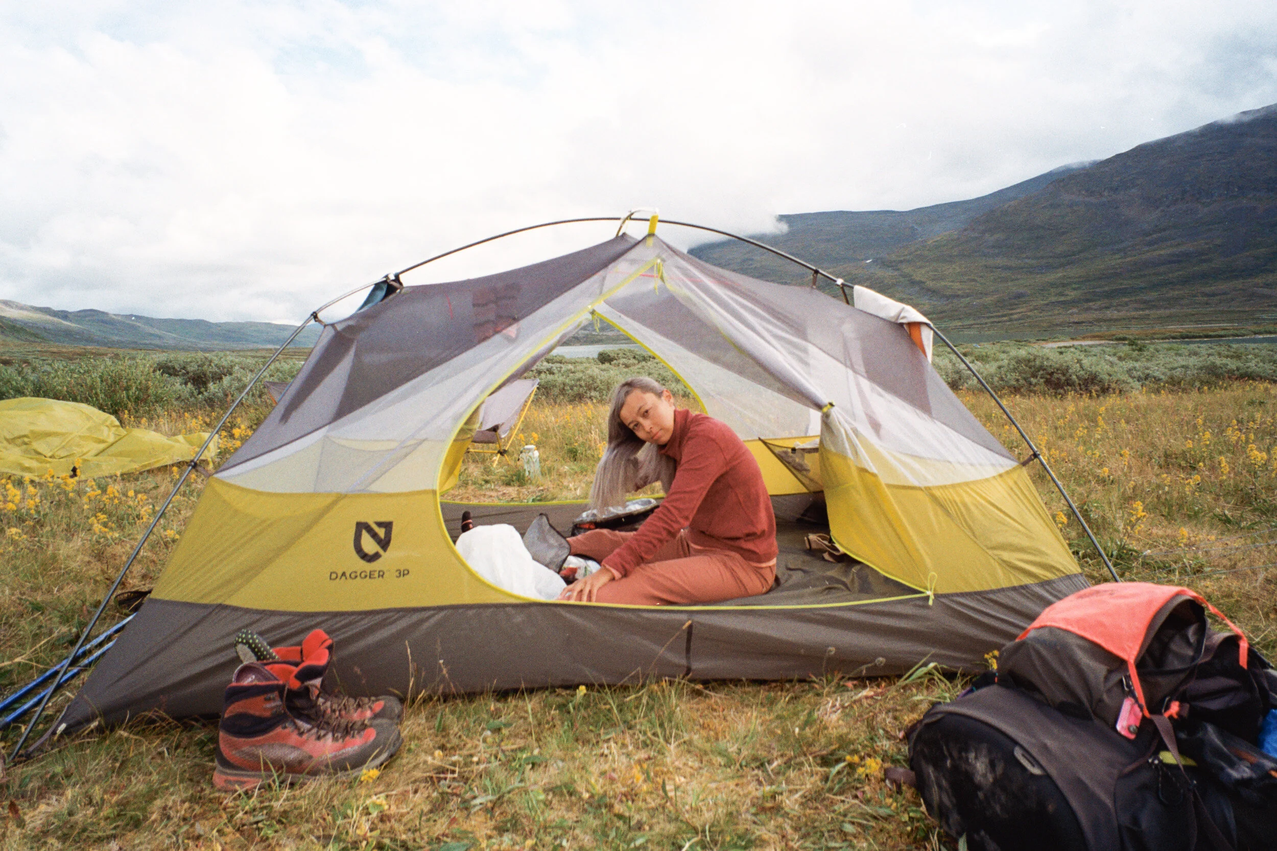
Except for a few iphone shots, these photos were all shot on film (it was easiest to bring film cameras since I wouldn’t be able to charge digital camera batteries on the trail).
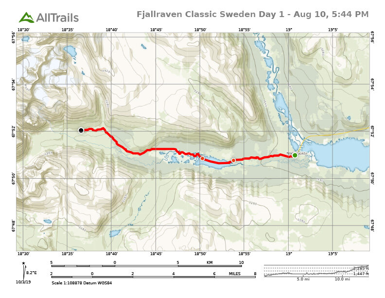
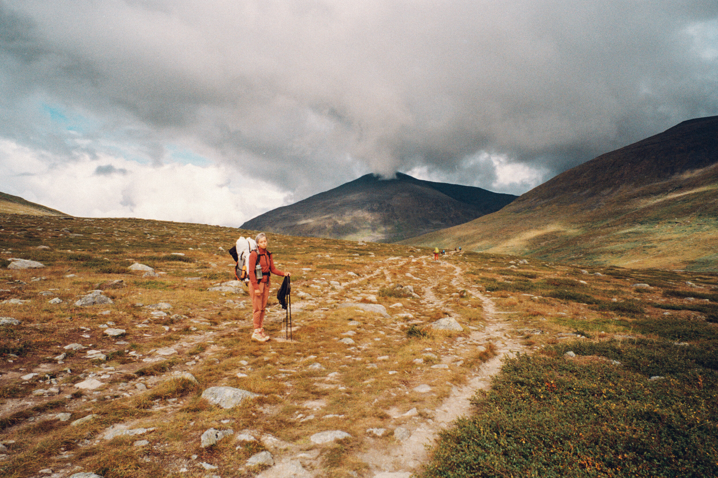
Day 1
Nikkaluokta – Kebnekaise
13.4 mi / 21.6 km

Here we go (yikes)
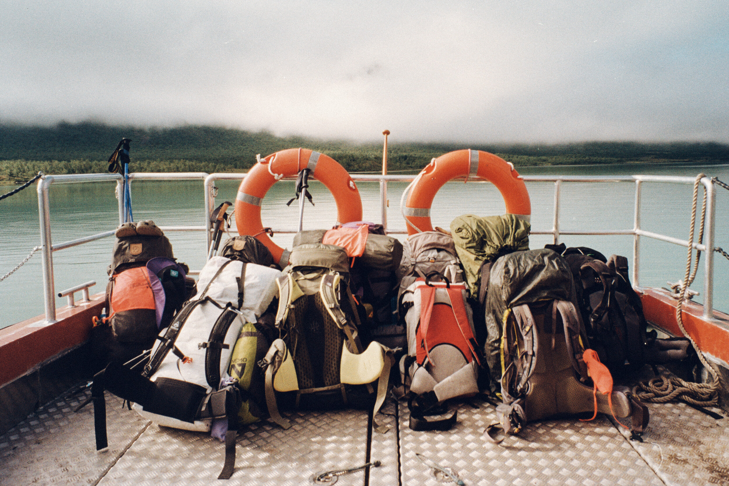
Glacier lake boat ride
Real Turmat food is good, but I can’t eat
Checkpoint, Kebnekaise and camp!
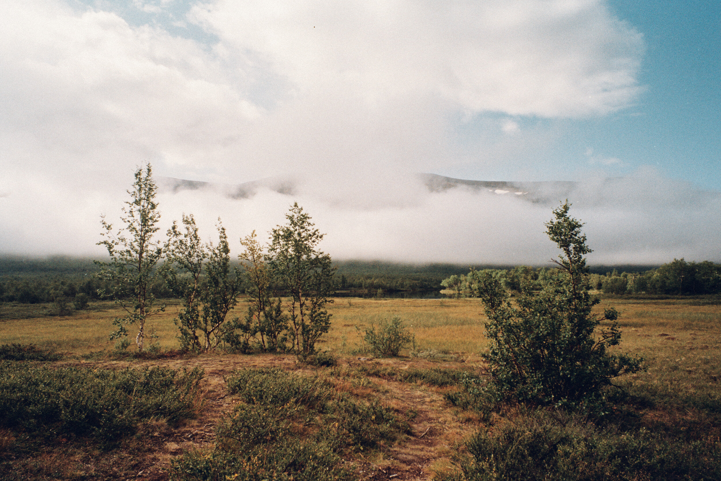
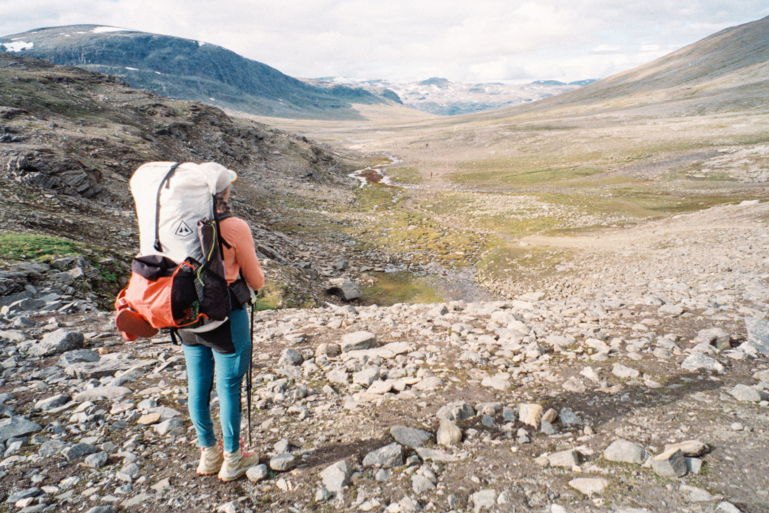
Day one on the trail went much better than I had expected. I assumed that the terrain would be more demanding (since I am usually hiking in California and going to places like the Alps or Dolomites, I associate hiking with steep, mountainous terrain), but the incline here was very gradual. After just 5km from the start, there was an optional boat trip that could take us across a lake, Ladtjojaure. Our start had already been delayed by a full day (due to train delays out of Stockholm), so we decided to skip walking those 6km and instead jumped on the boat. The scenic $30 boat ride ended up being the highlight of the day; quietly skimming over glassy turquoise water while passing green mountains obscured in fog.
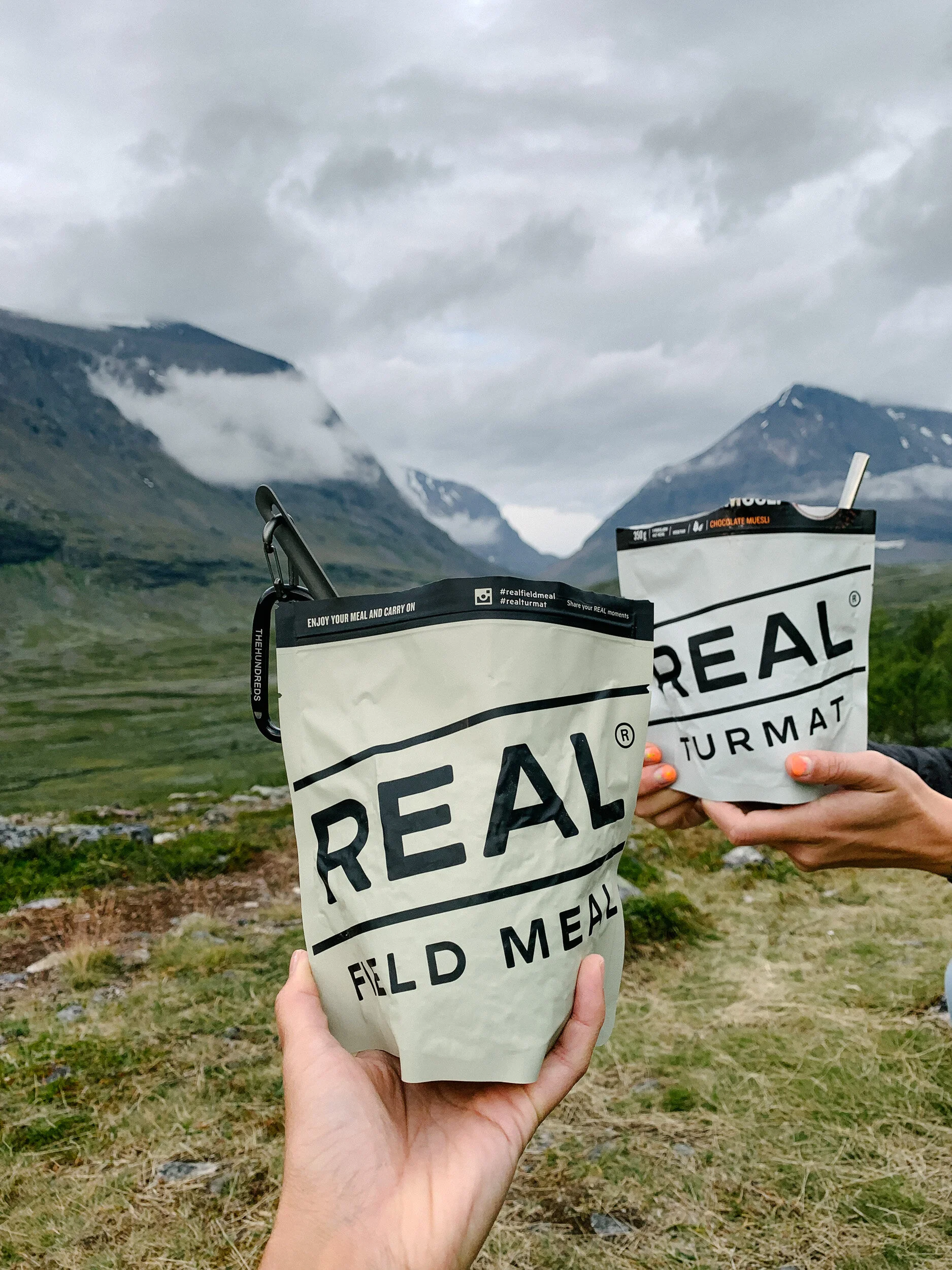
Once back on the trail, we settled into the rhythm of walking, stopping for a snack break, walking, stopping near a water source to fetch water for drinking and cooking, then walking some more. My first trail meal was vegetarian pasta made by the Norwegian camping food company REAL TURMAT. The pasta was super good, and even had bits of vegetarian “meat”. I had been struggling to eat for the past few days, but I knew that I would NEED to eat on the trail. I was able to force down half of the 500 calorie bag of food, before my stomach turned and I could no longer stand the taste or smell of it. I sealed the bag back up, and hoped for better luck with it later.
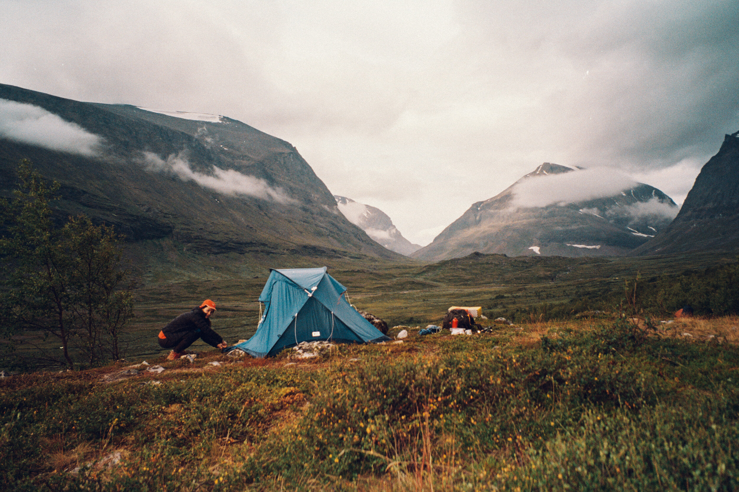
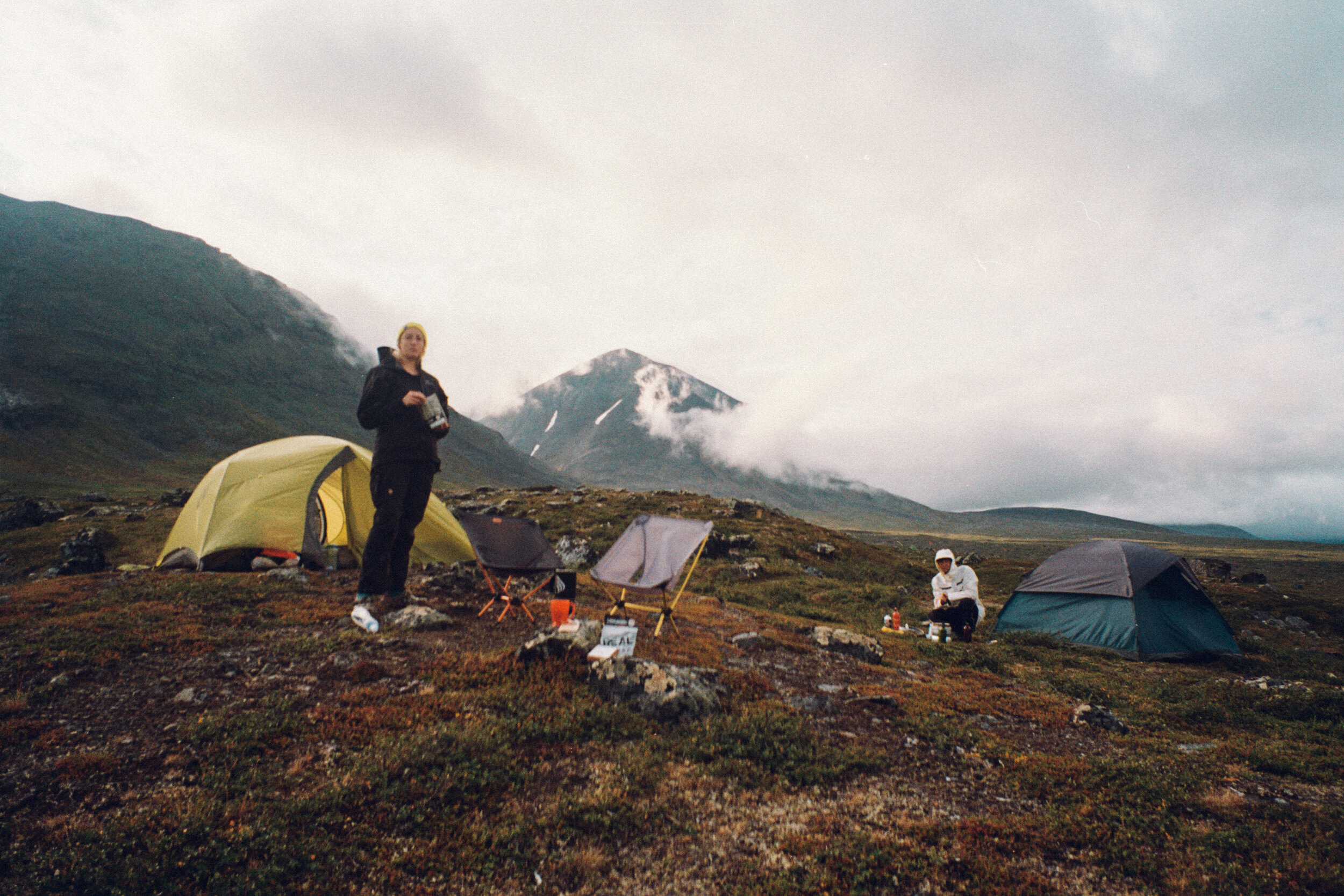
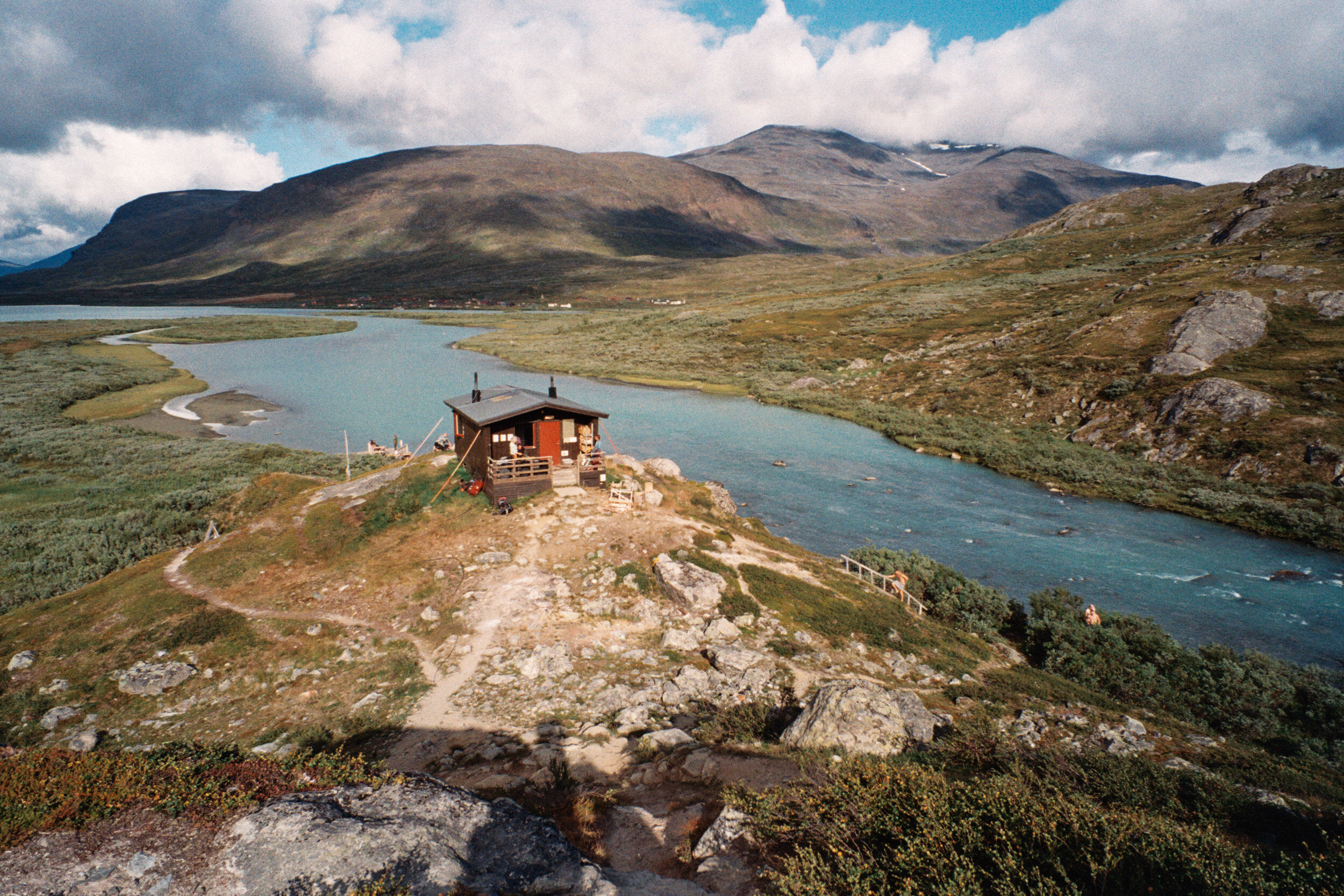
Before long, we reached our first checkpoint at Kebnekaise Fjallstation; a STF (Swedish Tourist Association) mountain station. To my surprise, the station was outfitted with a café, and full bathrooms (we joyfully took advantage of the last running water and flush toilets for the next 5 days). We easily could have continued walking, but we found a very nice place to camp just over the hill from the checkpoint. We set up camp there, and made dinner while surrounded by a panoramic view of the glacier carved valley and mountains, and Kebnekaise mountain (Sweden’s tallest peak, after which so many Fjallraven products are named). We watched as a reindeer ran through the valley, dodging hikers and their tents. It was a great first evening on the trail, and that night was neither wet nor cold, and I slept comfortably in the tent that Alex and I shared.
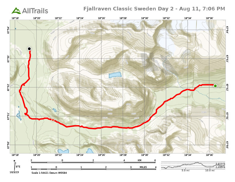
Day 2
Kebnekaise – SINGI - Halfway to Sälka
13.2 mi / 21.2 km
Anxiety & menstruation
Rain
Finally it stopped raining
What a nice campsite,
…Except for all of these f**king mosquitos
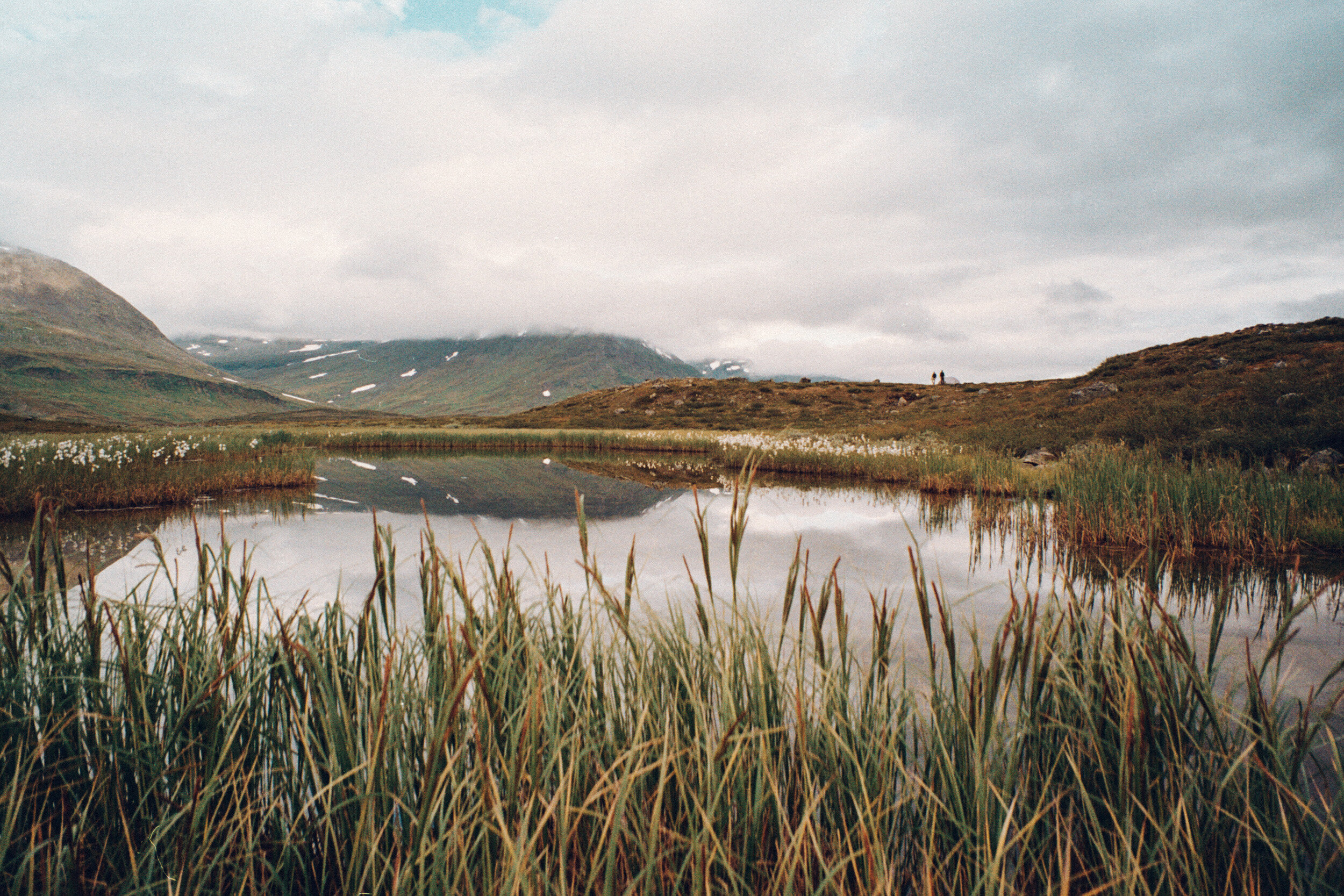
We made our first breakfast on the trail (the first of many days of REAL TURMAT rehydrated muesli- which ws also quite good). Still, I was only able to eat a half meal, but it was more than I was eating a few days ago. Once back on the trail, we hiked alongside Kebnekaise Mountain for some time, before leaving it behind in the distance. The weather was ominous and gray, and it felt like wet weather was inevitable.

Despite making it through the first day, I started to feel a lot of anxiety. The recent death of my cat contributed to an overall feeling of gloom and anxiety, which fed into my doubts and fears about doing this hike. I would think to myself that the further I went, the further I would have to backtrack if I was unable to continue. I was second guessing whether I should continue hiking… was I in any condition to be doing this? With only being able to eat partial meals, I feared I might get to a point where I didn’t have enough energy to keep moving. To make physical matters worse, my period started on day 2, and I was developing huge blisters on my feet. I wasn’t the only one not feeling great, Aya started to complain about having serious knee pain.
Then came the rain.
Maybe it’s because I’m from California where it never rains, but multi-day backpacking in the rain is not my idea of a good time. Before my cat died, I had been feeling pretty well prepared for this hike—but still—it was the rain that I thought would be the most challenging aspect of this hike for me. Setting up camp in the rain, getting everything wet, and then packing up a wet tent, to hike and repeat it all over again and again—— I feared getting wet and cold with no way to dry off and warm up. As it started to rain, I tried my best to stay positive. Alex and Xenia and I kept our minds occupied and passed the time by playing my favorite hiking alphabet game. Before we knew it, we had reached the next checkpoint at Singi.

The checkpoint was nothing more than a few tents set up in the middle nowhere, and there was no shelter from the rain. The Fjallraven event personnel stamped our trekking passes, and offered us food; flatbread wraps with reindeer meat (or alternately wild mushrooms), mashed potatoes, and jam. Hot food was a treat, but eating in the rain was a freezing cold and soggy affair. I asked for a half portion, which I wasn’t even able to finish. My rain jacket had become either permeated by rain or saturated inside with my own sweat. If we kept moving we could stay warm, but we had to wait at the checkpoint for Aya to talk to the staff doctor about her knee pain. She and her husband Andreas were seriously considering turning back, so we needed to wait to see what they would do. We walked down the trail a little further to wait at one of the STF cabins. As per the rules of the event, we were not allowed to go inside the STF cabins on the trail, but we took the little shelter we could against the outside of the building. Aya and Andreas eventually decided that they would continue, but that they’d continue at their own pace. We tried our best to stay together, but eventually would end up hiking separately from them.
If we walked only the distance from one checkpoint to the next each day, it would take 7 days to complete the entire route. We hoped to finish the route in 6 days, because on the 7th day we each had onward plans out of Abisko. We pushed on to try to chip away a few extra kms, while looking for a nice place to set up camp for the night. Meanwhile, the rain let up, and the break in the rain allowed our gear the chance to dry out a bit.
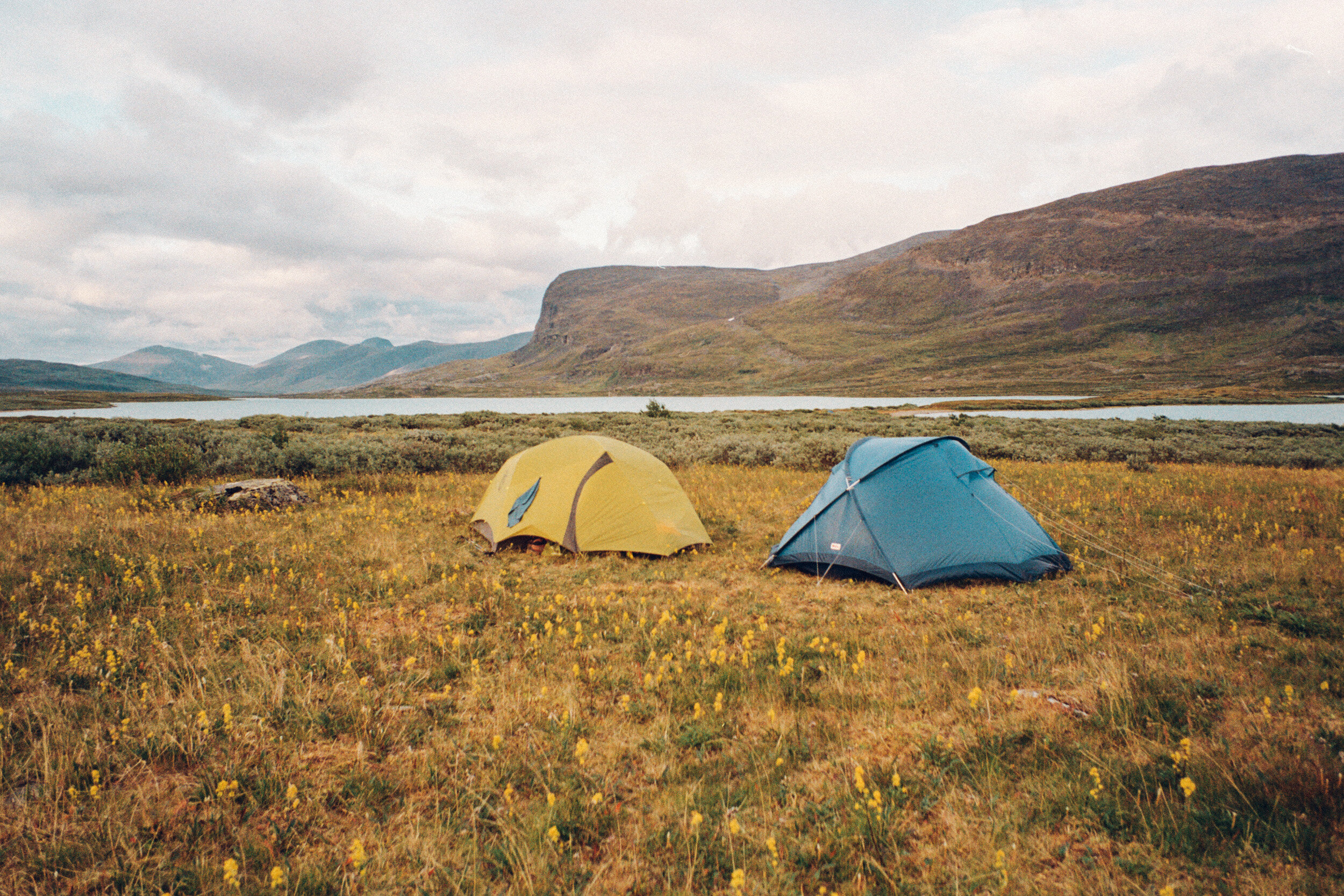
After a 13 mile (21km) day, I was beat. My feet hurt like they’d never hurt before, and I was completely drained. We found a nice mossy hill off of the trail, overlooking a lake in the distance, near a stream where we could fetch water for drinking and boiling to make dinner. We set up camp, and enjoyed the majestic scenery for just a few minutes before the swarms of bloodthirsty mosquitos sent us running into our tents.
DAY 3
Sälka – Tjäktja PASS
14.5 mi / 23.3 km

The longest and steepest day of trekking
Now I have a UTI and need to pee all the time
Nervous anticipation of the Tjaktja Pass
Relief once I was literally “over the hump”
Moonscape
The checkpoint that we could never seem to reach
The best camp site ever!
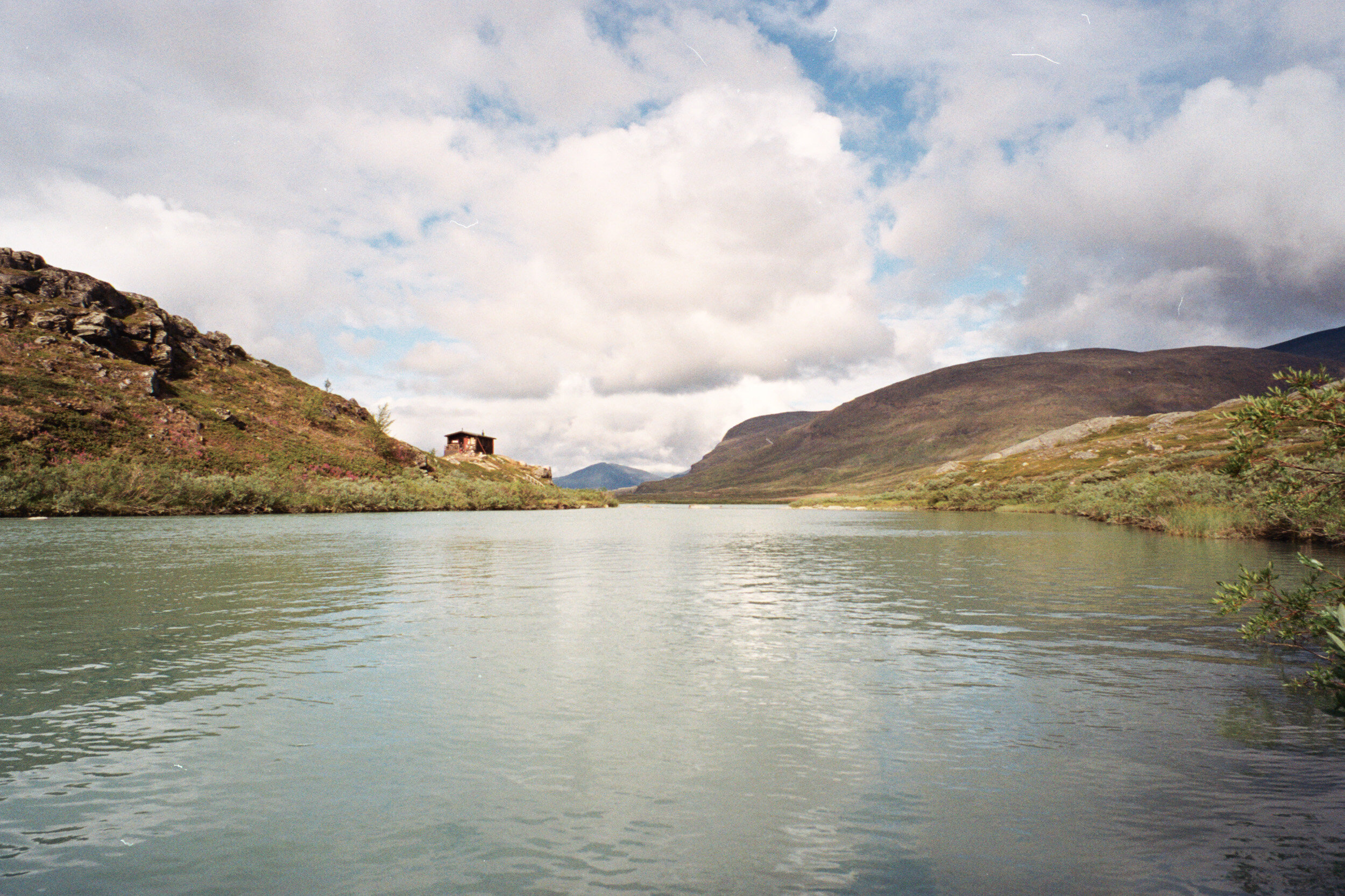
After a few miles back on the trail, we reached the next checkpoint and the picturesque, riverside STF Salka cabins. At Salka we could use the outhouses, and buy a few supplies from the store. It’s mind blowing that you can arrive at a hut in the middle of nowhere in the Arctic, where there is no cell service, no running water, yet somehow you’re able to buy crackers, soda, and feminine hygiene products using a credit card. There is also a sauna at Salka, but we had arrived too early in the day to use it.
At this point, I was developing a urinary tract infection. Maybe due to dehydration, or the anti-diarrhea medication I had taken? Whatever the cause, it was pretty miserable to deal with while hiking. I would frequently need to pee, at which point I could not hold it for more than a few seconds. This made for many awkward times when I had to run off trail and pee where there wasn’t much privacy to be had. Fortunately, I am a pro at using a FUD, or female-stand-up-urination-device (I highly recommend the Pstyle, I always use it while hiking, camping and road-tripping).
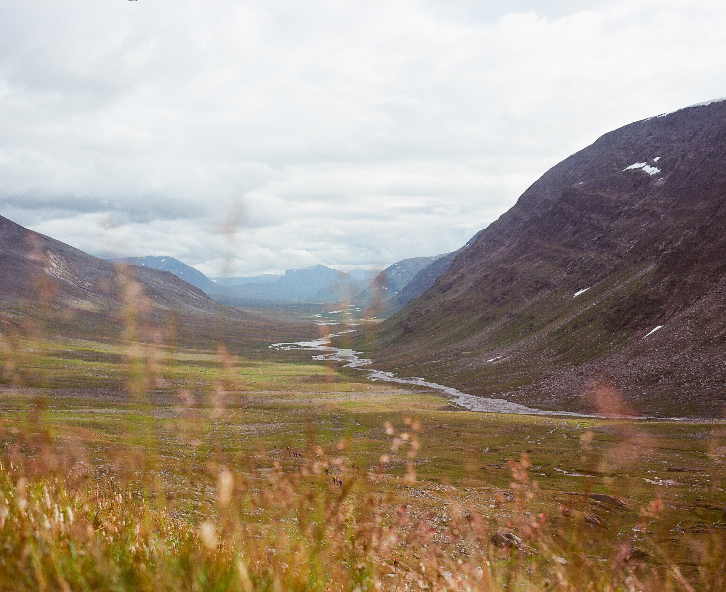
After the pit stop to deal as best I could with my growing list of bodily dysfunctions, we kept on trucking. The 7-mile stretch from Salka to the base of the Tjaktja Pass seemed to last an eternity. The trail followed a narrow valley, at the end of which we could clearly see the pass, but as we walked, it never seemed to get any closer.
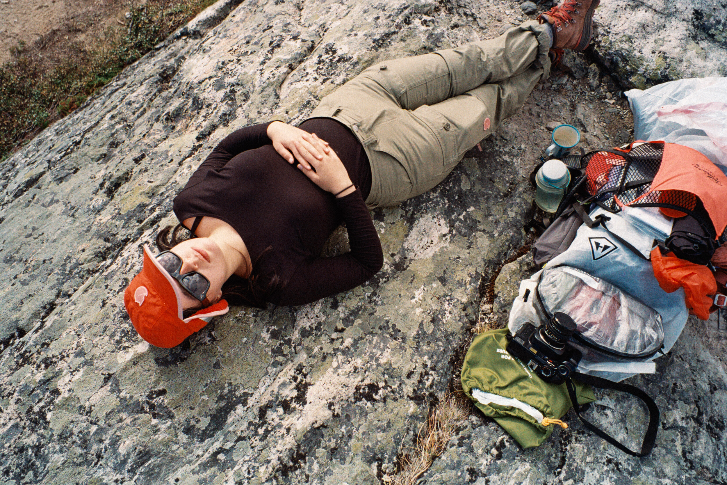
When we reached the base of the pass, it really didn’t look that bad.. it was just a big hill, really. I had been hiking up mountains steeper than this regularly around Los Angeles, so I didn’t feel too challenged by the Tjaktja Pass. I had built it up in my mind to be this massive mountain to scale, but it was only 700 feet of elevation over a mile and a half. Once at the top, we paused to take a few obligatory “we did it” selfies. I felt a tremendous feeling of relief while standing on the top of the pass. We had reached the highest point of the trail, and it would all be easier, downhill walking from here. We had also reached somewhere around km 55-60, which meant we were halfway done with the entire trail. From here on out we would be closer to the finish than the start, so I no longer needed to fear that turning back would be the best way to go if I had some kind of physical or mental breakdown and wanted out.
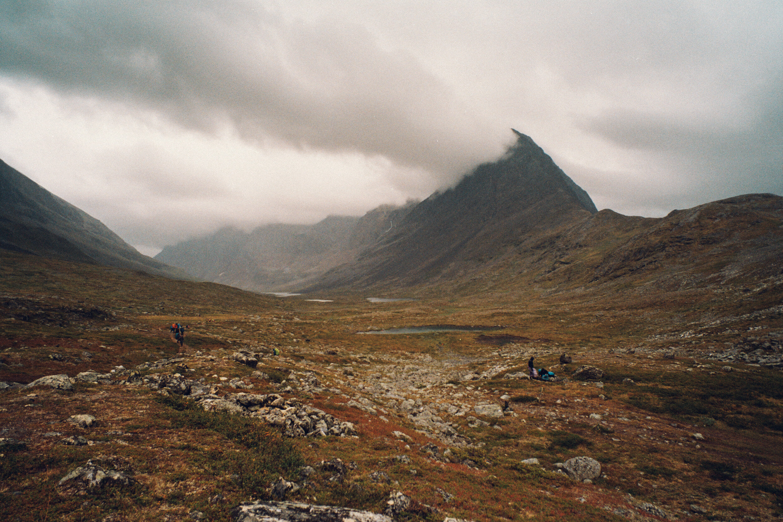
Once on the back side of Tjakta Pass, the landscape changed dramatically. I especially enjoy hiking in rocky mountain landscapes, and this place felt like a rocky moon-scape. Up here the weather was quite cold, so we kept a quick pace to stay warm, anxious to get to the checkpoint sooner than later. Our maps advised that there would not be anywhere suitable to camp until the checkpoint, so despite having already hiked 10 or 12 miles, we just had to keep going. The rocky terrain made for challenging walking, each uneven step had to be carefully placed, or else you might sprain an ankle. It was painful on my blisters to walk on the rocks, but I had learned to take Advil, and ignore the surface level pain.
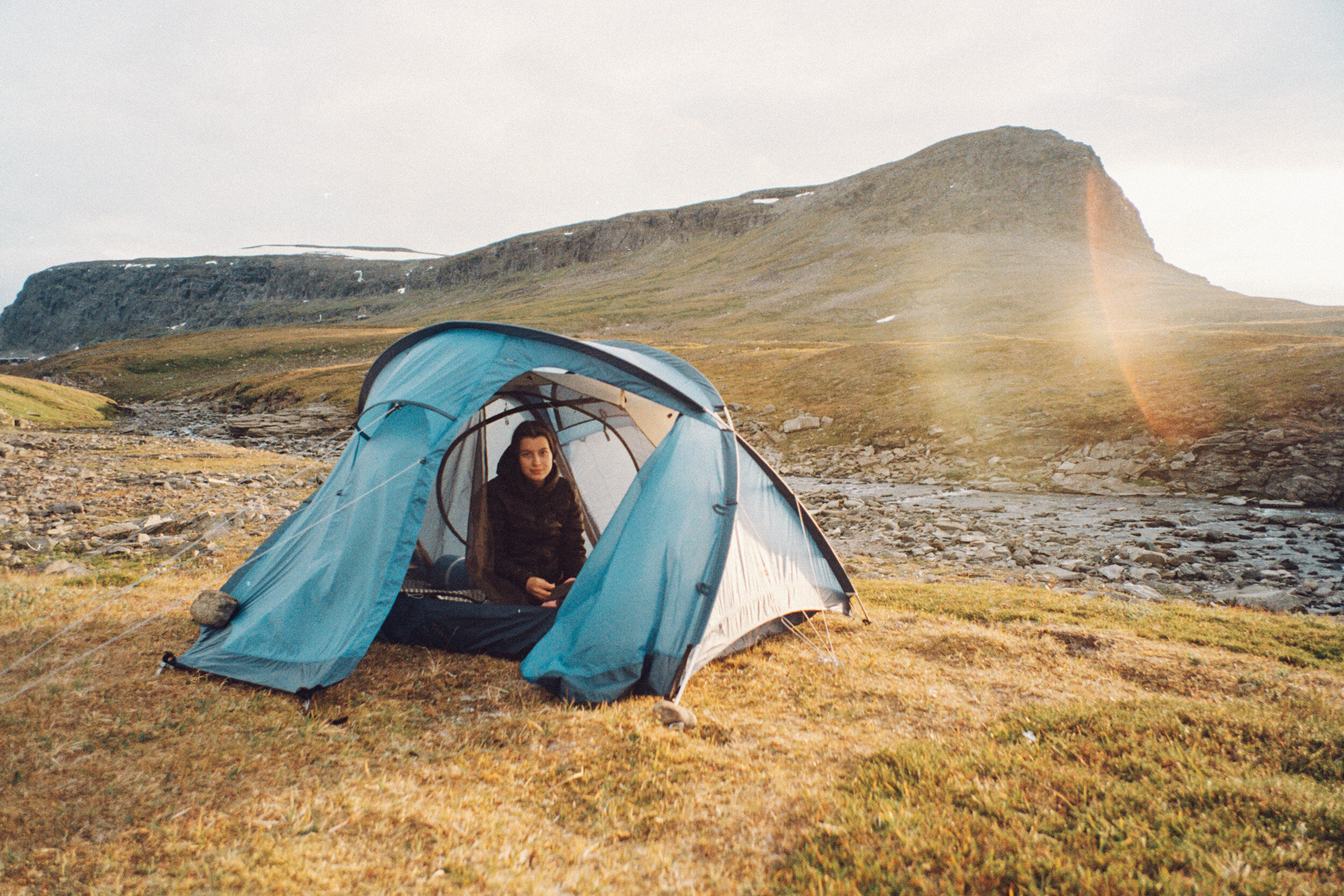
We kept thinking the checkpoint would be just over the next hill, but every time we got over the hill, it wouldn’t be there. It was pretty late in the evening and we were grumpy and tired and just wanted to get there. We didn’t make it to the checkpoint that night, I spotted a really cool camp spot next to a river and overlooking a small waterfall canyon and the valley below. It was the most perfect campsite with access to fresh flowing water, and just enough room for our tents. I was so happy to have this spot to ourselves, and to not have to walk anymore! The wind was blowing quite hard down the valley from the pass, so we had to carefully set up our tents, or risk our loose things or the entire tent blowing into the canyon below. If wind had one advantage it was that there were—temporarily—NO MOSQUITOS. As the sun set, the wind stopped, and the mosquitos started feasting on us. We tried to have a nice little family dinner outside, but had to run for cover from the mosquitos to eat, and then remain inside our tents.
DAY 4
Tjäktja - Alesjaure
9.9 Mi / 15.9 km

Shortest, easiest day of trekking
Food refill (…more Real Turmat)
STF Alesjaure: the most beautiful mountain station
SAUNA!, swim in the river, and a “shower”
The loveliest campsite
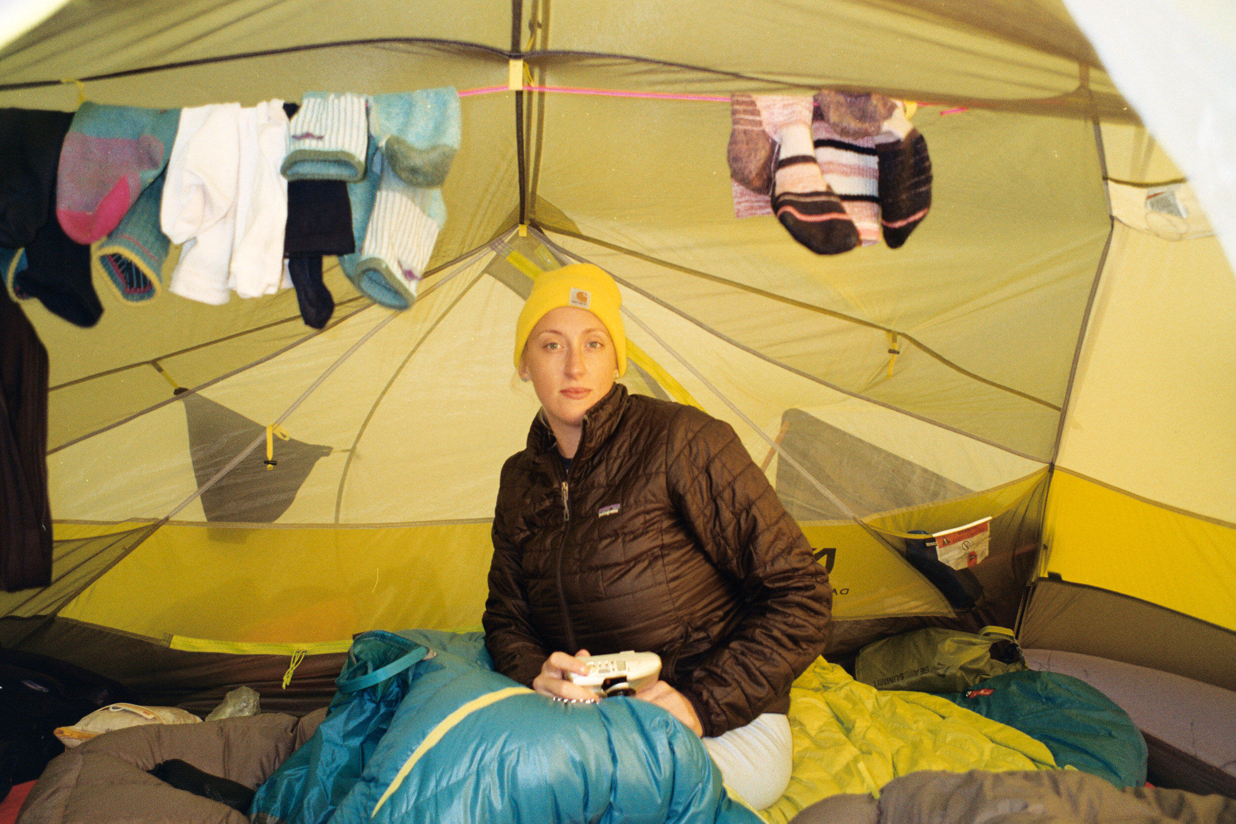
When I woke up in the morning, my mosquito bitten face was completely swollen. One or both of my eyelids had bites, and were swollen to where they only opened halfway. I also had a whole bunch of bites on my cheek, and the area was so swollen to the point where it looked like I was sucking on a gum ball. I couldn’t help but laugh at my ever growing list of physical issues; having no appetite, diarrhea, getting my period, a urinary tract infection, and now I was covered in swollen bug bites (my face looked like a catcher’s mitt). I am not someone who gets sick often, I have a strong stomach, and I am not prone to allergies and infections. I guess that when they talk about going out into the outdoors and learning to deal with “adversity”… this was my intro course.
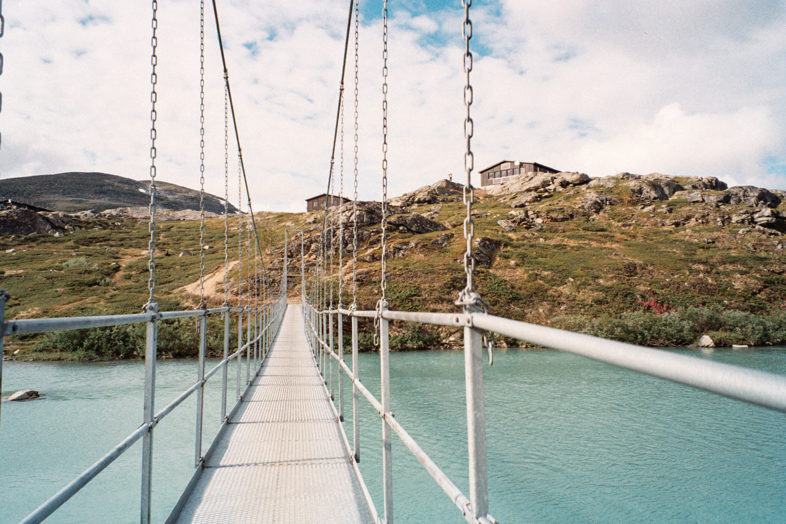
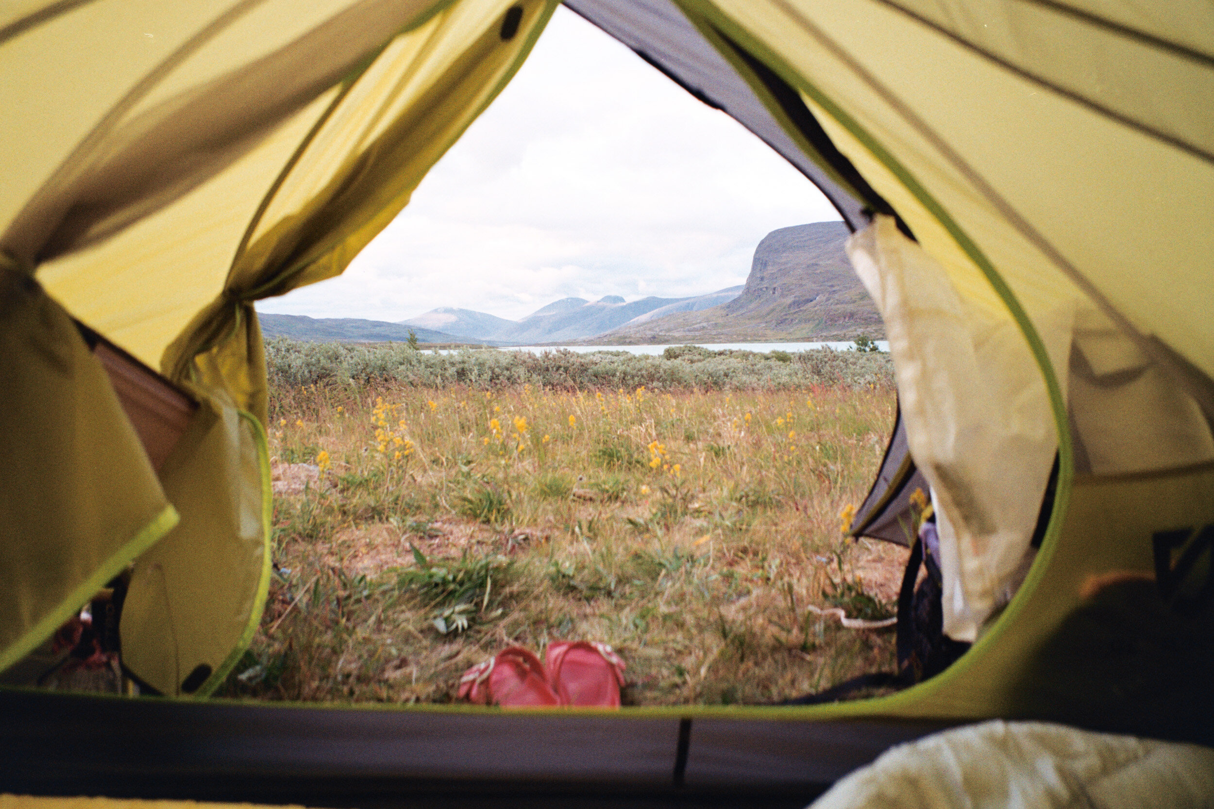
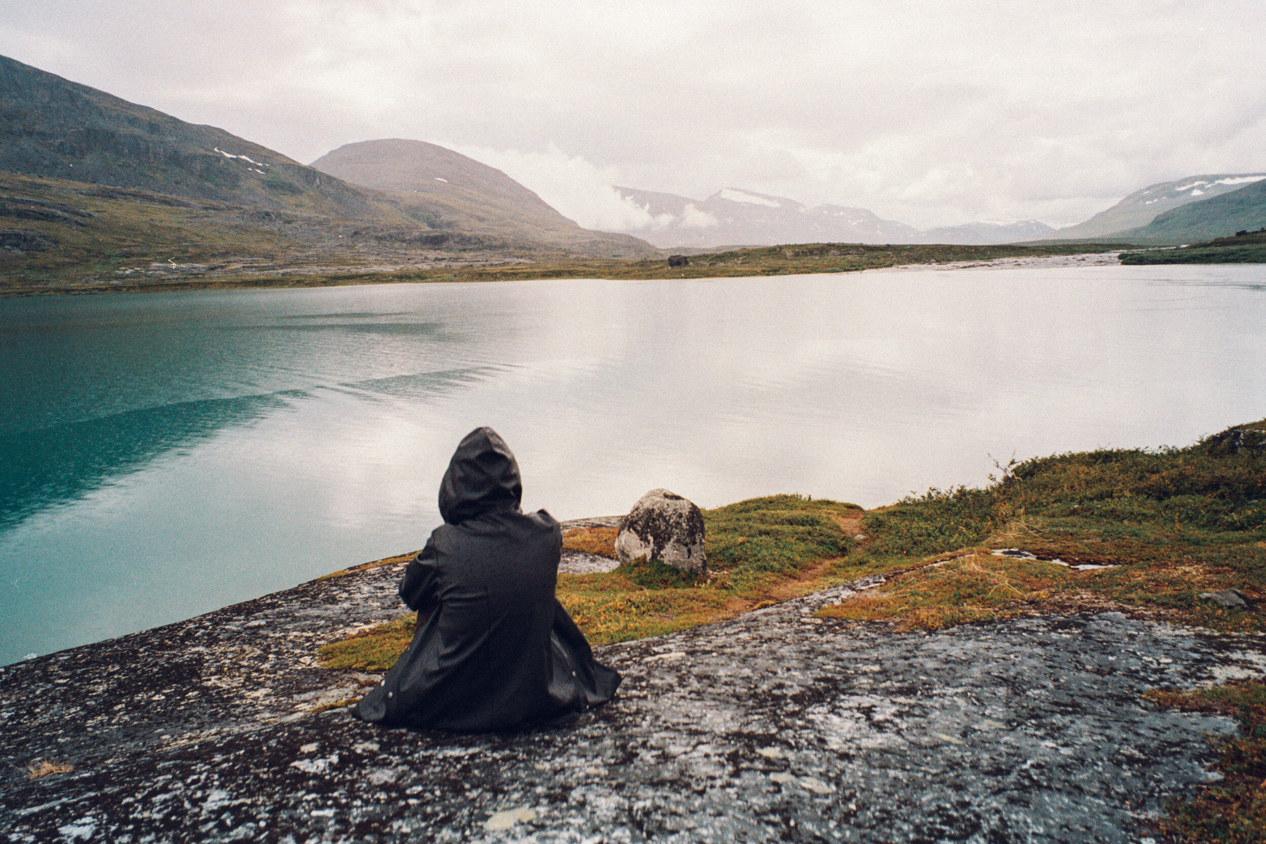
I feel like you’ve stepped up your hike game when you do a 9.9 mile day and think of it as a “short” day… Day four was a much needed break after Days 2 & 3. Today the sun came out, and the path that followed the river into Alesjaure was flat and smooth. The scene was wide and open, and arriving to the Alesjaure STF Hut was like arriving to the gates of heaven. A suspension bridge crossed a sparkling turquoise river, on the other side was a little village of black cabins and huts perched atop a hill.

Sauna fresh!
Once there, we looked around hoping to find Aya and Andreas (they had started hiking earlier than us in the morning to get a head start). We couldn’t find them, and there was no way to know how far ahead they may have hiked, so we had to just hope to catch them on the trail or at the next checkpoint.
At the little shop we bought snacks and soda. Best of all, there was a free sauna, so we took a proper break to warm our tired muscles, followed by an icy rinse in the river, and then a piping-hot-water bucket bath in the bath house connected to the sauna. After 4 days of hiking without a shower, hot water was the ultimate luxury!
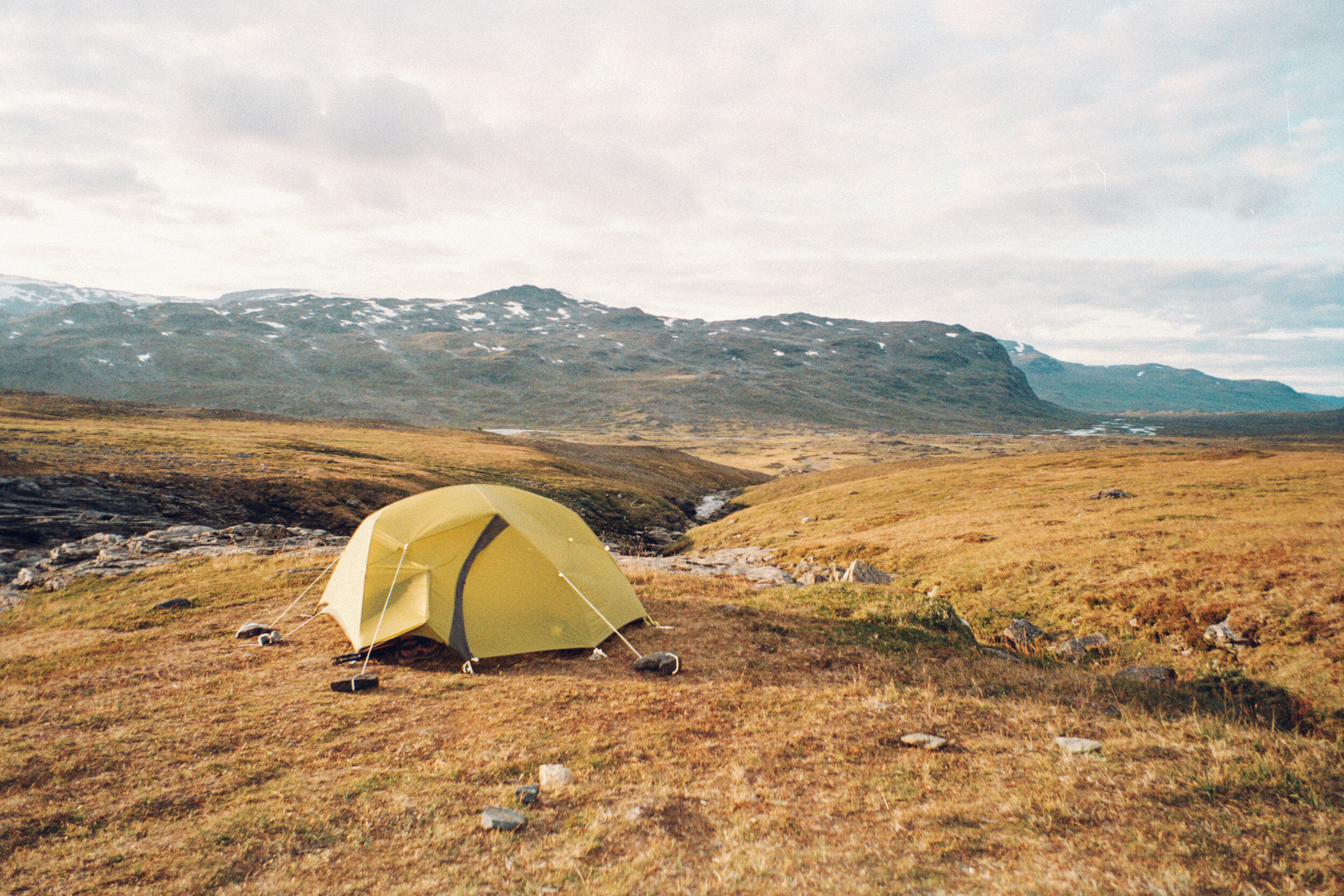
We walked just a few kms further and set up camp in a lush, grassy field, right next to a river, with a view of the mountains and lake.
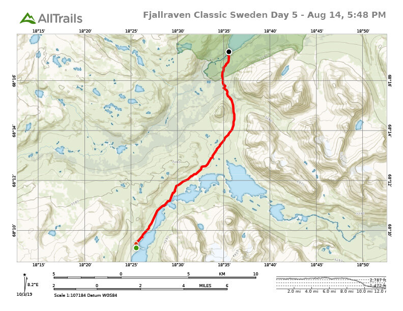
DAY 5
Alesjaure - Kieron - Abiskojaurestugorna
12.5 mi / 20.1 km

Scenery for days
Rain on, rain off
Thirsty
Questionable water
Walking down a mountain in the pouring rain
PANCAKES!!!!!!
Rainy campsite with 300 other people
Day 5 started as our driest stretch of trekking, and by the end was our wettest.
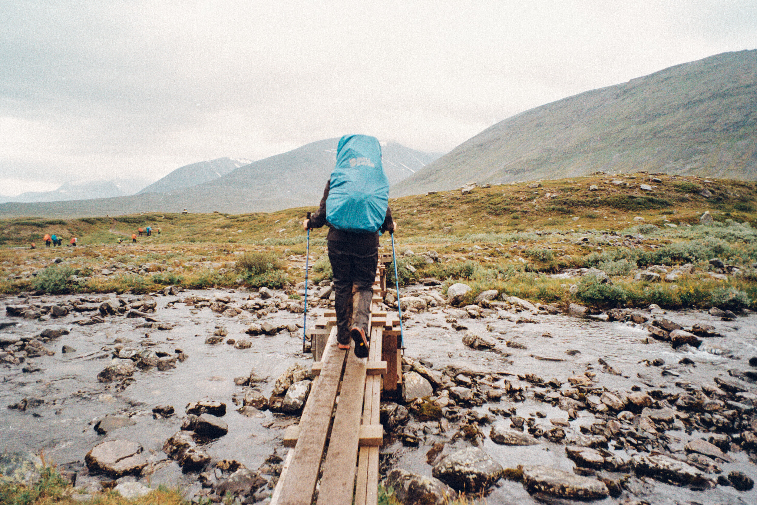
In the morning, our lovely riverside campsite provided ample water for cooking, drinking, and even a quick rinse. We filled up every last bottle we had for water, at Alesjaure we were told that we would have quite a long stretch where there would not be any streams, about 10km or so. Because fresh water was so readily available on the trail (no filtration necessary), we had been advised that we’d only need to bring 1/2L - 1 liter water bottles each. The trail followed a long chain of turquoise lakes, which was a bit ironic considering we had no access to drinking water (without knowing whether our one filtration bottle was adequate to filter any impurities or contaminants in the lake, we didn’t want to risk it).
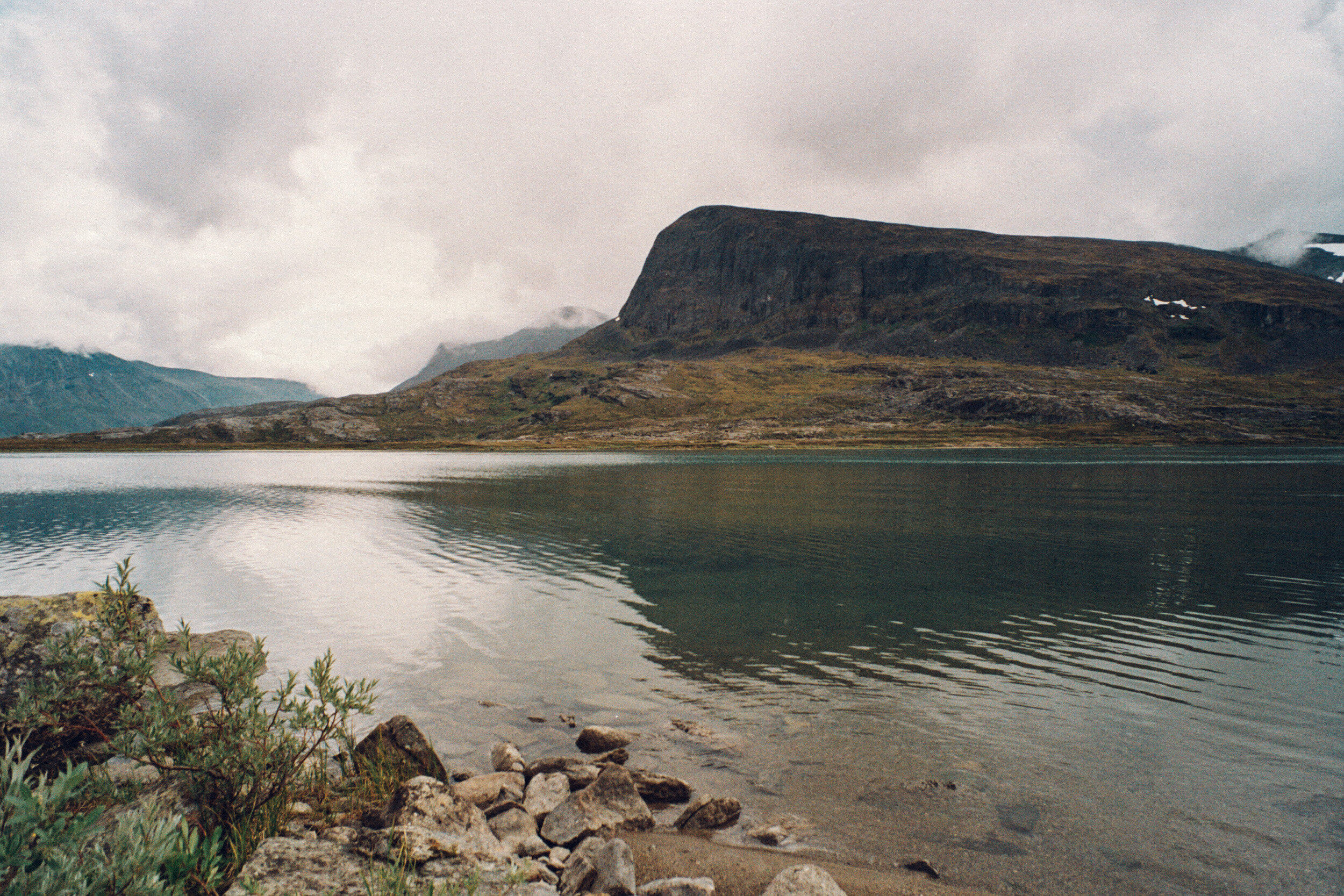
The scenery was absolutely breathtaking; we walked across from Njuikkustakpakte Mountain, and its silhouette reflected on the lake. Raindrops started to fall on the lake, and then for the rest of the day the weather became intermittently rainy. Each time it started to rain, we had to stop completely to unbuckle and remove our heavy packs and put on our rain gear. Once we started hiking again, like clockwork, after a few minutes the rain would stop, and we would overheat and have to stop to remove our packs and shed the layers we just put on. It was frustrating how many times we had to put rain gear on and take it off, each time we’d try to go longer, but hiking without them when it was wet, or with them when it was dry, would eventually become too cold or too hot.

After many hours on the trail, we started to wonder where the next stream was, and when the dry stretch without water would end. After 14.5km/9 miles of hiking without a water refill, we came to a algae filled, barely moving, stream that a few brave souls had stopped at to collect water for cooking. We had become too hungry and thirsty to not use the water, so we first filtered the water using our filtration bottle, then boiled it with our stove for several minutes, before using it rehydrate our Real Turmat meals, and bottled it for drinking once it cooled.
Once energized by food and water, we got back on the trail. The intermittent rain turned into steady rain, and finally a downpour. The last few miles to the checkpoint felt like an eternity of navigating along a single-track trail of slippery rocks and dense greenery. When we finally arrived to the checkpoint, my jacket and shirt were soaked through. The checkpoint offered the most delicious treat; the Fjallraven staff was preparing warm crepes with fresh whipped cream and jelly, and hot tea— and just like that, my appetite was back! I gobbled down my cup full of pancakes, and wished for more.

It was late afternoon and we were already tired, but there didn’t appear to be any decent spots to camp around the checkpoint. We put back on our packs and hiked another 2km into Abisko National Park, where we could pay to camp at the Abiskojaurestugorna STF Campground. The tourist station huts were situated on a picturesque lake, but we arrived in the pouring rain to a completely jam-packed campground, with nowhere to set up our tent. People were getting cutthroat about finding places to camp, so we eventually settled on a barely large enough spot of ground in between several other tents. There was no beautiful view to wake up to, but our options were very limited, since wild camping wherever you want is not permitted within the boundary of Abisko National Park. We set up our tents in the pouring rain, and fortunately this was the first and last time we would have to do so. A bunch of our gear became soaked, the insides of my shoes were literally filled up with water. Thankfully, the station had a small drying room, where I was able to dry out my jacket and shoes overnight. That night I prepared my dinner from inside of the rain fly of the tent, and that night we slept to the peaceful sound of rain drops falling on the tent. In the morning, the rain was still coming down, and we had no choice but to pack up everything in the rain. This was the scenario that I fear we would have to deal with everyday on this hike, but very fortunately it only happened on the last night and morning on the trail. I had no problem hiking with wet clothes and gear, because THAT NIGHT I would be sleeping in an actual bed, in-fucking-doors!

DAY 6
Abisko National Park to the finishline
9.7 mi / 15.6 km
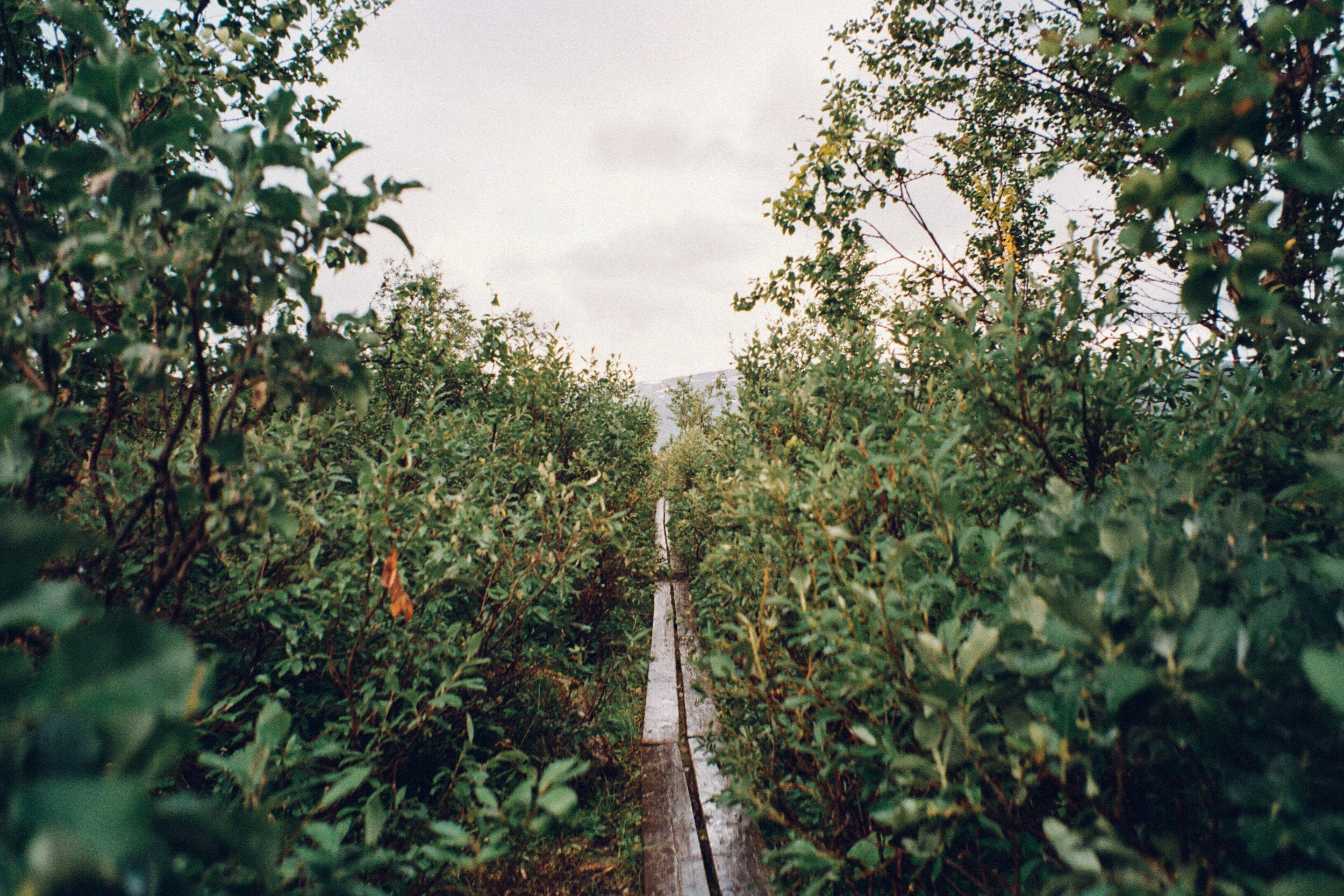
The last leg of hiking was entirely through Sweden’s Abisko National Park. I had expected the National Park portion of the trail to be the most special in some way, but I was a little underwhelmed by the scenery for the majority of the day (let’s just blame it on the gloomy weather). The trail followed the edge of Abiskojaure lake through a wooded area, where the trees were too tall and dense to allow for much of a view of our surroundings. Without much to look at, I kept my eyes on the trail and picked up the pace. Even after 5 days of hiking 10-15 miles, this last 10 mile stretch felt like the longest yet.
The nearer I got to the finish line, the less anxious I felt to finish. In the last 5 km, the landscape became much more interesting. I paused at a horseshoe bend in the river where white rock under the surface rendered the water a turquoise color. I reminded myself to stop and be present for the last moments of this experience. I became overcome with emotion, thinking about how this was likely the first and last time I’d stand in this place, thinking about how far I’d come (despite how much I had doubted myself), and knowing that a return to reality was just a few more minutes down the trail. This experience in many ways was a healthy distraction from my grief from my cat dying. I may have thought that walking for days would have left me with a lot of time to dwell on my sadness, but it didn’t. I had been existing in an alternate reality, where each day I had one goal (to walk a lot), and very few choices to make (except whether I wanted pasta or stew for dinner). I had to manage immediate physical pain and mental struggle in order to get through each day, and was left with very little room for thoughts that did not relate to the present task at hand.

Within the last kilometer of the trail, my cell phone caught service and the messages from the past few days started to come in. I broke down and sobbed when I read a message that my boyfriend Jason had sent me; he knew that I was out of reach, but he was so sad and alone at home without me in the wake of our cat’s death. I wanted to call him, but it was currently the middle of the night back home in Los Angeles.
Alex and Xenia had continued walking when I stopped at the river, and by now they were probably wondering where I was. I dried my eyes and got back on the trail, I didn’t want to take so long for myself that they would reach the finish line without me. Of course they didn’t finish, they had been waiting for me just a little ways up, and I caught up with them to walk the final steps of our 110km journey together.
The approach to the finish line was very quiet with very few people to be seen, but as we walked up the hill to the Abisko Tourist Station and caught sight of the banner and flags marking the finish, cheers and applause broke out. It felt like the entire crowd of people at the Trekkers Inn were watching us and cheering on our finish, it was quite the pleasant surprise! Cheering us on and filming our finish was Aya and Andreas, who we had lost track of after day 3…they had actually finished the night before us! We sat down with Aya and Andreas and some of our fellow trekkers, and ate some very tasty falafel, and drank a much needed cold beer. An overpriced $8 beer never tasted so good!!!

